Library Research Guides
Library Research Guides
An index map for each quadrangle and project is filed in the box with the quadrangle, right behind the divider tab. The index maps are photocopies and quality varies. You may wish to pull the corresponding USGS quadrangle map from the Alaska topographic map case next to the photographs to see a more detailed map.
The index map shows all the flight lines over that section, and each image is marked with a crossed line. Once you have identified a point of interest, use the index map to identify the image number closest to that point. Note that images have a high degree of overlap.
About every fifth image point on the map will be labeled with its image number. For image points in between, it is necessary to interpolate to come up with the image number. Along the flight lines, image numbers may increase or decrease in either direction, North or South, depending on the direction of flight while the photographs were taken. Once you know the image number you are looking for, go to the photograph set for that quadrangle, and follow the image numbers on the top right corner until you come to the one you need. Note: some photographs are missing.
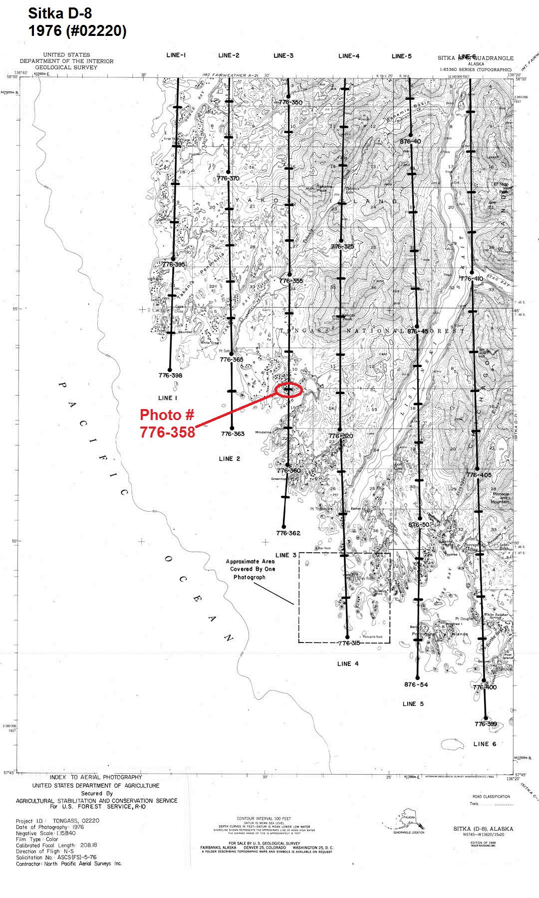
In the example below, the map shows a portion of Yakobi Island in the Sitka D-8 quadrangle. The image point circled in red on the map is over the area of Squid Bay. The circled point falls between labeled image numbers 776-355 and 776-360. Counting 3 points down from 776-355, we find that the image point over Squid Bay is image number 776-358, shown on the right.

If you have a photograph in hand and are trying to identify it, first turn it over and look for the notation of the USGS quadrangle name. Then look for the 5 or 6 digit project number on the front of the photograph. Also note the image number on the upper right side of the photograph. Locate the storage box for the quadrangle, and within the box, look for the divider tab with the matching project number. Find the index map for the photograph set in the pocket of the divider. Locate the image number from your photograph on the map. You may need to interpolate between labeled points on the index. To pinpoint the location more quickly, it is helpful to note the flight line number on the photograph, and then locate that line on the map.
For example, in the photograph above (#776-358), the project number is 02220 and the flight line number is 3.
Research Guides by Egan Library | University of Alaska Southeast are licensed under CC BY-SA 4.0![]()
![]()
![]()